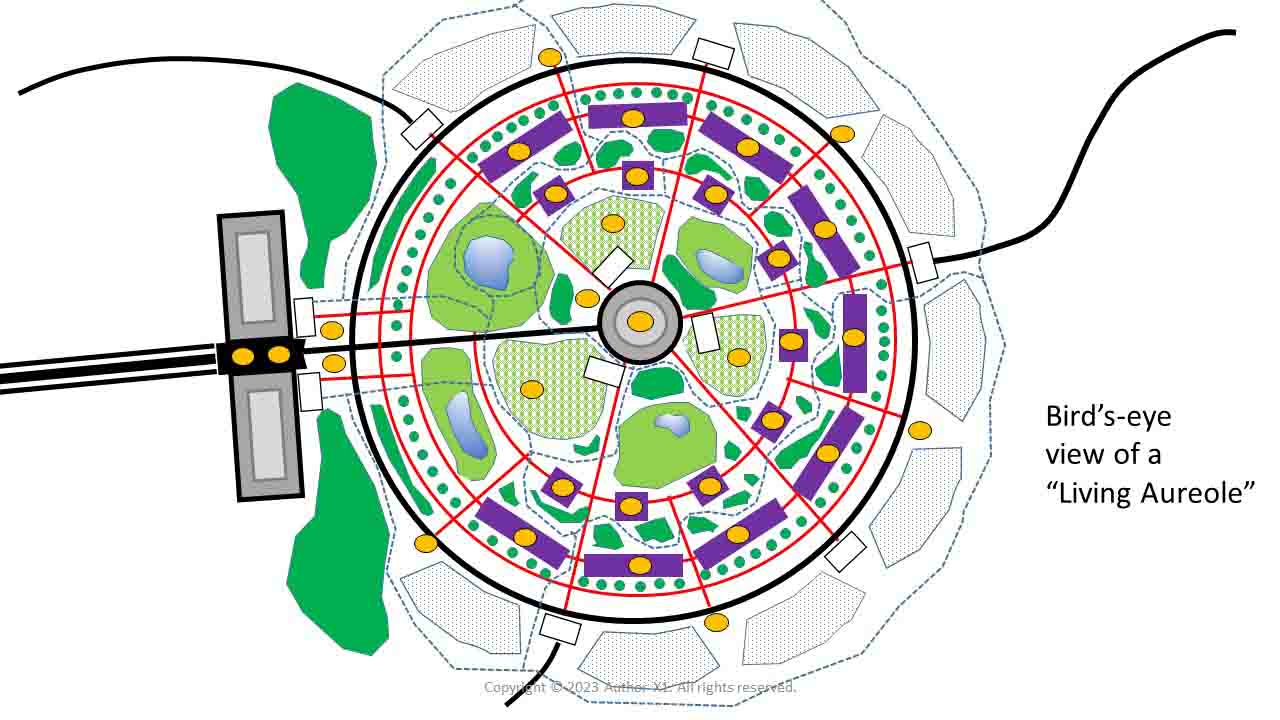
The diagram above depicts a typical "living-aureole" node.
There are many nodes
world-wide, and the collective set of nodes is
integrated. The system is built as a quality-of-life
solution for the disenfranchised. Architecturally,
it is designed to maximize
the use of virtual immersion, in order to minimize resource
consumption, with respect to sustainment of
organic human bodies. Aureole residents live and
interact
primarily in virtual space.
No organic
humans are needed to maintain the system. Robots and
algorithms do it all. The system is completely
self-sustaining, requiring zero tax subsidization.
The diagram
shows the infrastructure layers of a single aureole
node,
superimposed on top of one
another. To learn about a specific layer, click on the applicable link below:
--
Habitat Buildings
(purple rectangles and squares in diagram)
--
Service Center
(gray circle at center of diagram)
--
Industrial Center
(gray double-rectangle at left)
--
Primary Roads
(black lines)
--
Secondary Roads
(red lines)
--
Cross Transport
(heavy black triple-line at left)
--
Biking Walking Paths
(dotted blue wandering line)
--
Drone Landing Pads
(yellow circles)
--
Parking Lots
(white rectangles)
--
Solar Collection Fields
(dotted blue octagonal shape on peripheral at right)
--
Agriculture Zones
(dotted light-green areas)
--
Parks and Ponds
(solid light-green areas)
--
Beautification Areas
(solid green areas)
--
Virtual Space
(not shown in diagram)